

 Menu
Menu
Winsford Town Park: the park in a clough
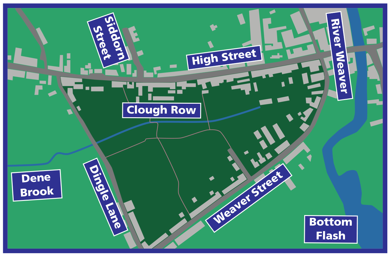
Location of Winsford Town Park and the Dene Brook, based on OS Six-inch survey, 1899
Winsford Town Park, in Winsford, Cheshire, lies within a small valley or clough (a northern English dialect word, pronounced "cluff", meaning a steep-sided valley).
The Tithe Map of the township of Over, c.1846, is the earliest detailed map of the area, showing the clough divided into six fields. Each field had a name – Bank Meadow and Hill Field are two names that hint at the steepness of the valley sides.
A road and cottages built in the mid-1800s parallel to High Street backed onto the valley and was named Clough Row. The road and cottages are now gone, although the name survives in the more recent Clough Road, on the opposite side of the valley.
The clough is also known locally as "The Drumber", a Cheshire dialect word meaning a wooded, shady hollow or dingle. Both "drumber" and "dingle" are preserved in nearby road names (The Drumber and Dingle Lane).
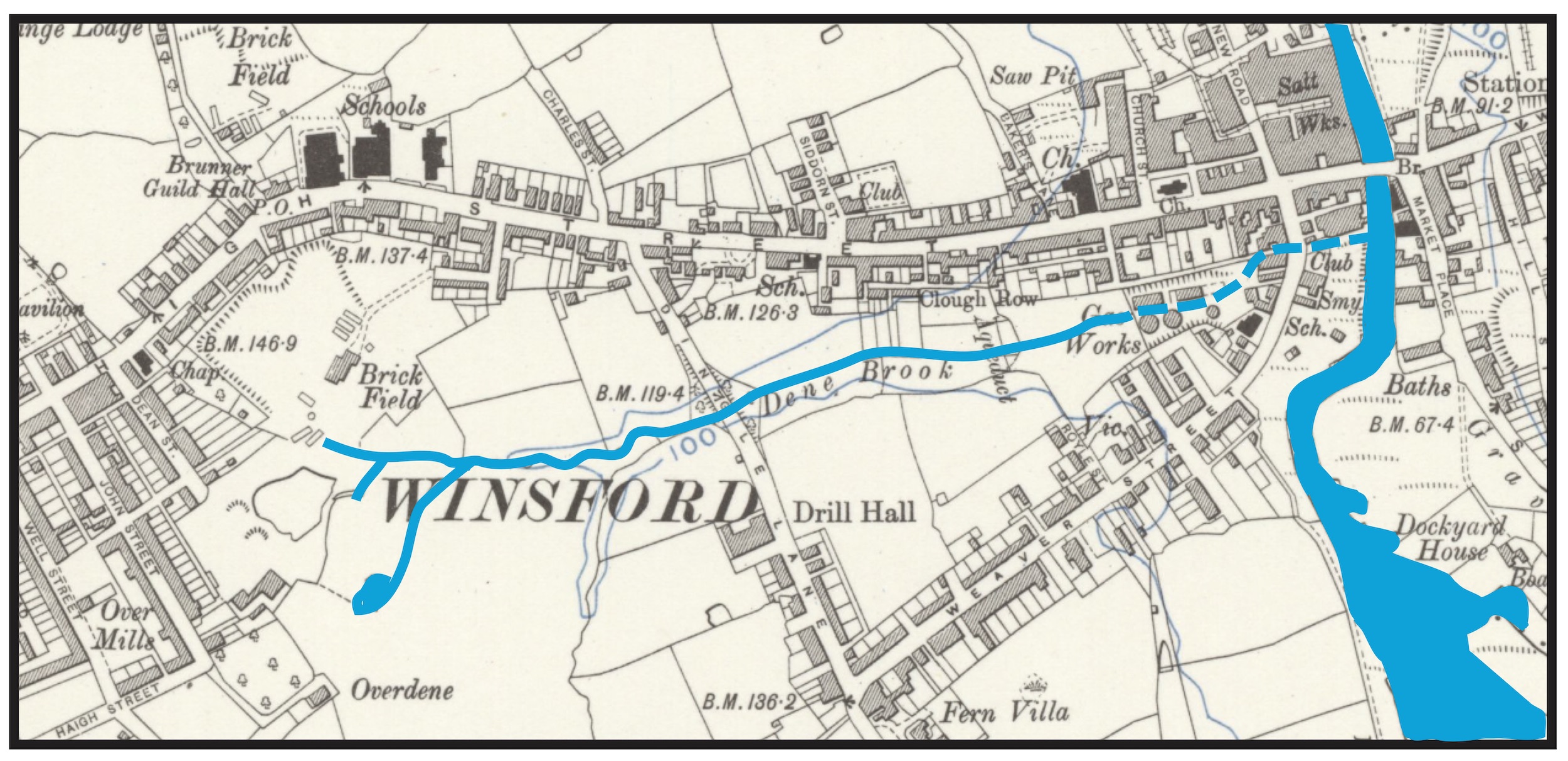
The Dene Brook flows through Winsford Town Park into the River Weaver. Dashed line shows
the first section to be culverted, c.1857, when it was made to flow under the newly-built
town gas works at the lower end of the clough. The brook remained visible in the upper part
of the clough until 1973, when the remaining length was culverted.
(Course traced from the OS Six-inch survey, 1908, and Winsford Annual Report, 1919.
Reproduced with the permission of the National Library of Scotland.)
The Dene Brook: Winsford's lost watercourse
The Dene Brook flows the length of the clough along the valley bottom, until it reaches the River Weaver. Marked on old maps the Dene (or Dean) Brook can be traced about half-a-mile to the west, to the area of Dean Street, John Street and Well Street, where springs come to the surface: these are the brook's source.
The brook's name is derived from the Old English (Anglo-Saxon) word denu, meaning "valley". Then, as now, a striking feature of the landscape, denu eventually became the name of the brook itself – Dene Brook, which literally means "valley brook".
The Dene Brook still flows through the clough, but has been hidden from view since 1973, when it was culverted: it is Winsford's lost watercourse.
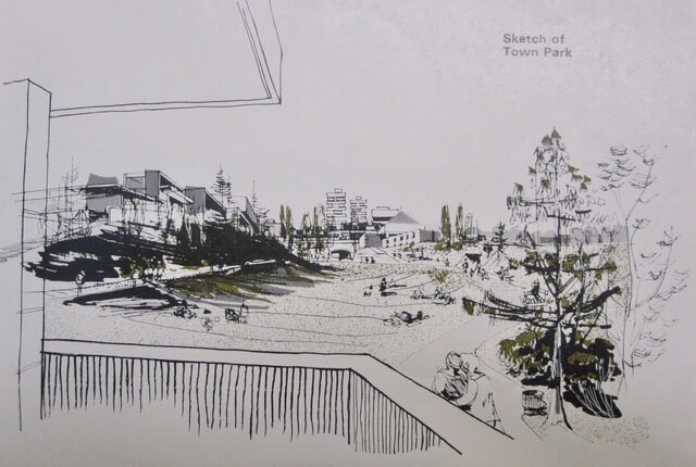
Artist's impression of Winsford Town Park, 1967: the high-rise buildings seen around the edge of the park, and from where the view is sketched, were never built
"A New Green Heart for Winsford"
In 1967, the Winsford Town Plan outlined the creation of a new town park "centred on Dene Brook and the clough".
A feature article in the Crewe Chronicle, 1 June 1967, said: "The widening of High Street will provide a new tree-lined boulevard between the river and the shopping centre, the removal of buildings on the left-hand side going up will open a view of Dene Brook Clough which can be turned into a natural town park. Shoppers may then walk through this park from Town Bridge under Dingle Lane and directly into the new shopping centre."
In the same article, a Cheshire County Council planning officer stated: “We suggest the south side of High Street will disappear, and what you will get in replacement is a town park. The present High Street carriageway will remain intact but become a dual carriageway."
Work began in 1972, when Winsford Urban District Council (predecessor to today’s Winsford Town Council) received a £54,460 grant from the Department of the Environment towards the cost of laying out a new park on the “Dene Clough”, as the area was described. The grant was 85% of the total estimated cost.
In a feature article headlined "A New Green Heart for Winsford", the Winsford Chronicle, 28 September 1972, said: "But the biggest change in Winsford's pattern will come with the widening of the lower High Street and laying out of the Dean Clough park on the south side of the new dual carriageway right down from the shopping centre to the river. This will give a view right across the sloping clough towards Weaver Street, and will open out the whole prospect of lower Winsford."
The following year, 1973, the Dene Brook was culverted at a cost of £21,666, and it disappeared from sight as it was made to flow along an underground channel. At around this time, Clough Row was demolished, and paths were laid out along the clough.
A piece of Winsford industrial history was installed in the new park in 1974 – a propellor and crankshaft from a salt barge, taken from a vessel that had sunk on the River Weaver. Set up by Winsford Urban District Council, together with a plaque, at a cost of £2,500, the propellor became a notable feature of the town park, until it fell into disrepair and was removed (buried in situ, according to a verbal report from a council officer).
Winsford Town Park today
Winsford Town Park was transformed in 2017–18, with a £1m investment from Cheshire West & Chester Council. New entrances and paths, a play area, multi-use games area, and seating were laid out. Ponds were created, a planting scheme was established, and sculptures were installed.
Winsford Town Park was opened to the public on 27 June 2018. In 2021, Winsford Town Park was awarded a Civic Award for Public Realm Improvements, coming first in the Design and Conservation category.
Winsford Town Park is owned by Cheshire West & Chester Council and is leased to Winsford Town Council, who have day-to-day responsibility for it.
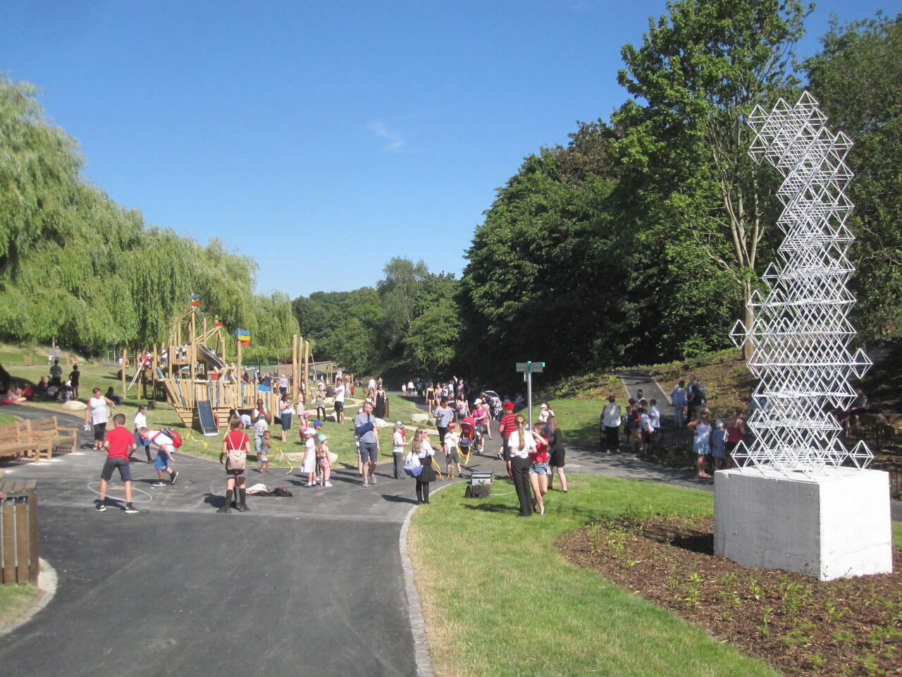
Winsford Town Park on the day of its opening, 27 June 2018

